
Environmental initiatives
The Marshes
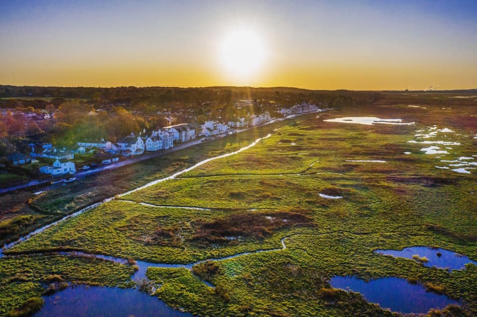
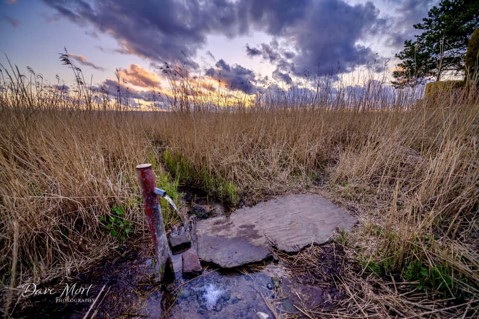
The marsh at Parkgate is a relatively recent feature; the grass began to appear just before the Second World War, about 80 years ago. Since then it has spread enormously, as the ground level has risen substantially with the continual deposit of silt. Now we have a vast expanse of tidal saltmarsh, which is owned by the RSPB; it is an ideal support for an abundance of birdlife, which feeds on the insects which thrive here, particularly the well-known Parkgate mosquito. The importance of this area for wildlife conservation and protection has been recognised by its designation as a Special Area of Conservation (SAC) and by its listing under the international Ramsar treaty; it is also designated as a Site of Special Scientific Interest (SSSI).
Unfortunately, the high tides bring in a mass of debris, which is left behind on the ebb; and to this is added the litter left behind by unthinking visitors. Our Community Spirit team keep the area under observation and undertake regular litter picks in the area adjacent to the seawall. The Society continues to monitor the state of the marsh and undertake regular litter picking
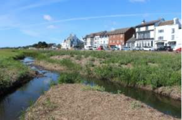
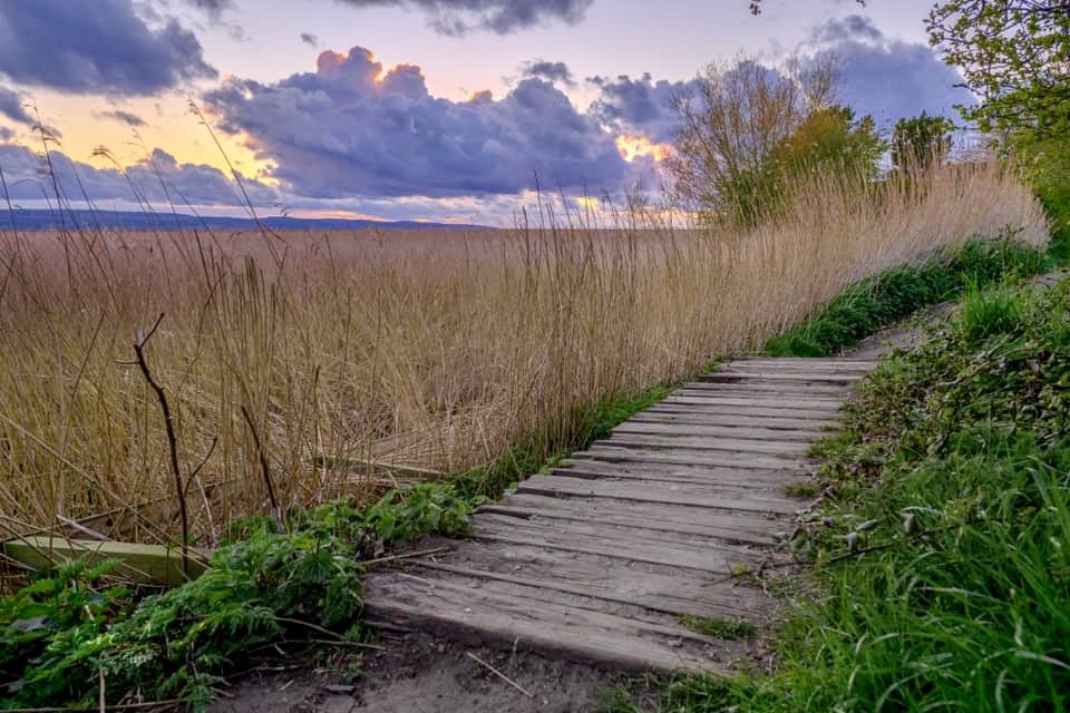
At times The Parade can be a very congested area with little room for traffic and visitors of all kinds. The marsh could offer an opportunity to disperse the crowds, if some public access could be devised, which would not compromise the welfare of the wildlife which inhabits it. In the neighbourhood plan the notion of a green beach adjacent to The Parade has been suggested; this could also encompass a boardwalk, which has also been mooted as a means of providing extra circulation space and greater proximity to the wildlife.
Actions: the Society is consulting with the Council over ideas to promote greater public access to the adjacent area of the marsh, including the feasibility of creating a boardwalk.
Mosquito Monitoring Project
UK mosquitoes do NOT transmit any diseases but may cause a biting nuisance in the Neston and Parkgate area at certain times of the year, most typically in April and May and especially in late August and September. These peaks follow a few weeks after inundation of the breeding pools on the marshes by the spring high tides. In most summers these breeding pools dry out and the mosquito larvae die, but if they are sustained by heavy summer rains the biting nuisance may persist to some degree during the summer months.
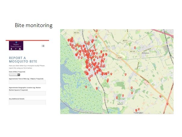
In recognition of this, local amateur entomologists maintain a weekly surveillance of typical breeding pools on the marshes at Little Neston and sample up to four traps catching adults around Parkgate and Neston. From these results and the weather forecast for the week ahead, they publish a unique Mosquito Biting Nuisance Forecast for the coming week on the Neston Town Council website and on the “Neston Life” App (available on Android and the Apple App Store).
Getting Involved: you can report any mosquito bites you get to the project via the Neston Council website or through the apps. This will help to build a better understanding of this nuisance.
Actions: the Society continues to work with CWaC to provide adequate funding for combatting mosquito nuisance: maintaining the drainage channels and creating additional ponds;
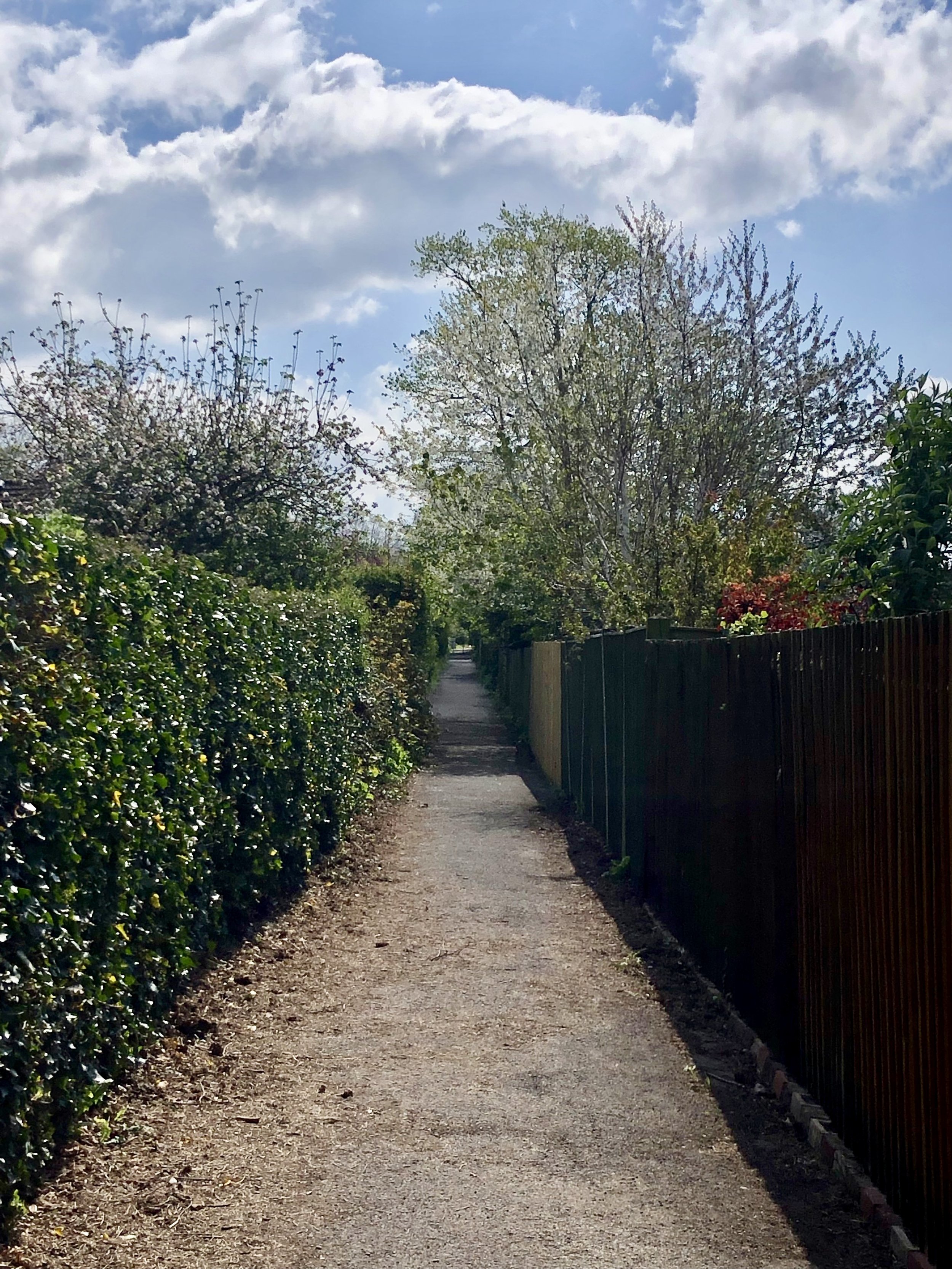
The wirral way
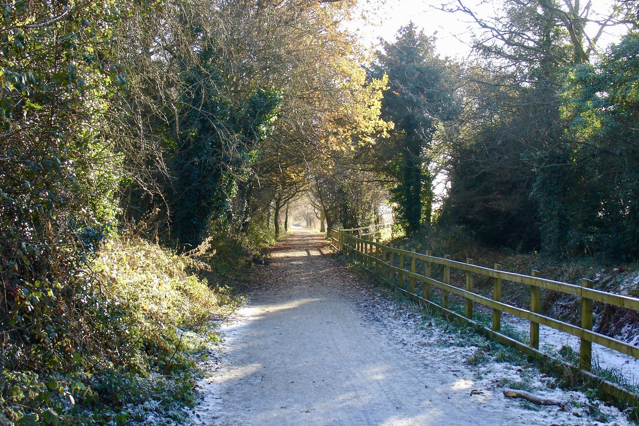
The Wirral Way was formally opened in 1973 as the first country park in Britain. It passes through Parkgate following the track-bed of the former railway line from Hooton to West Kirby, which closed in 1962. For the whole of its distance of 12 miles there is provision for walkers, cyclists and horse riding. It is well connected with other local pathways and is well-used by locals and walking groups from elsewhere. Maintenance is carried out by the Council’s Greenspace service, but in the Parkgate section there are problems of flooding at times of heavy rainfall, particularly near Boathouse Lane and into Station Road; this latter problem needs further investigation. It is generally necessary to keep the gullies free of debris so as to ensure that any floodwater can get away safely.
Actions: the Society continues to monitor the Parkgate section of the Wirral Way and report any impending problems to Cheshire West and Chester Council’s Greenspace services.

The Wirral Way in spring © Brenda Marple
The Ropewalk and other local paths
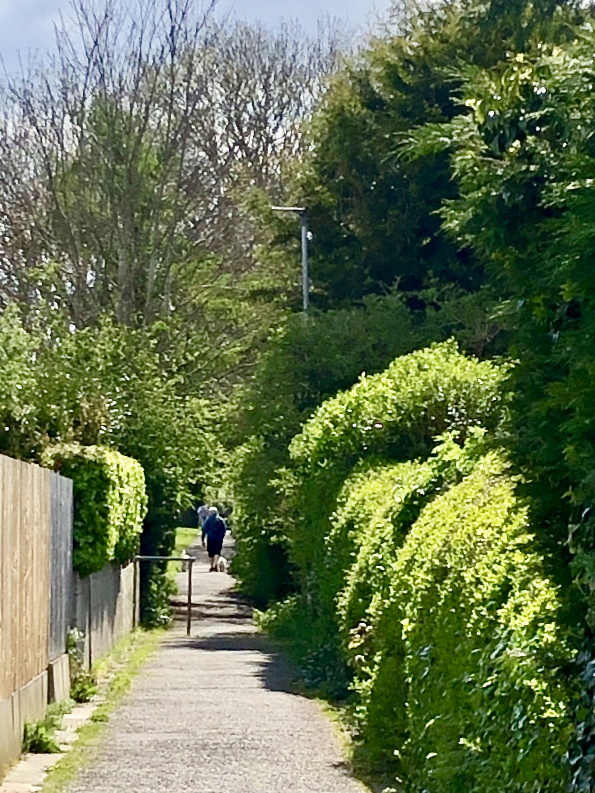

The Ropewalk is an ancient right of way; its name suggests that it was once a place where rope was made for the ships that were built or repaired in the shipyards which existed at Parkgate during the 18th century. From about 1814 to the mid-1970s it became known as Cheltenham Walk in recognition of its new role following the demise of Parkgate as a port, as place where visitors could parade and socialise if the weather on The Parade was not suitable for those activities. Today the Ropewalk is an important pathway, particularly for children walking to Parkgate School. There is, however, a continual problem of maintenance, as vegetation encroaches from neighbouring properties. Similar problems exist with the ‘back path’, which leads from Bevyl Road to Brooklands Road, and the unadopted path between Bevyl Road and The Looms. The ‘cow path’ between Brooklands Road and Wood Lane is often overgrown and needs more regular maintenance; brambles are a nuisance for pedestrians and cyclists.
Actions: The Society is working with Cheshire West and Cheshire Council to implement a proper routine for monitoring the state of these important local paths and taking enforcement measures where appropriate.


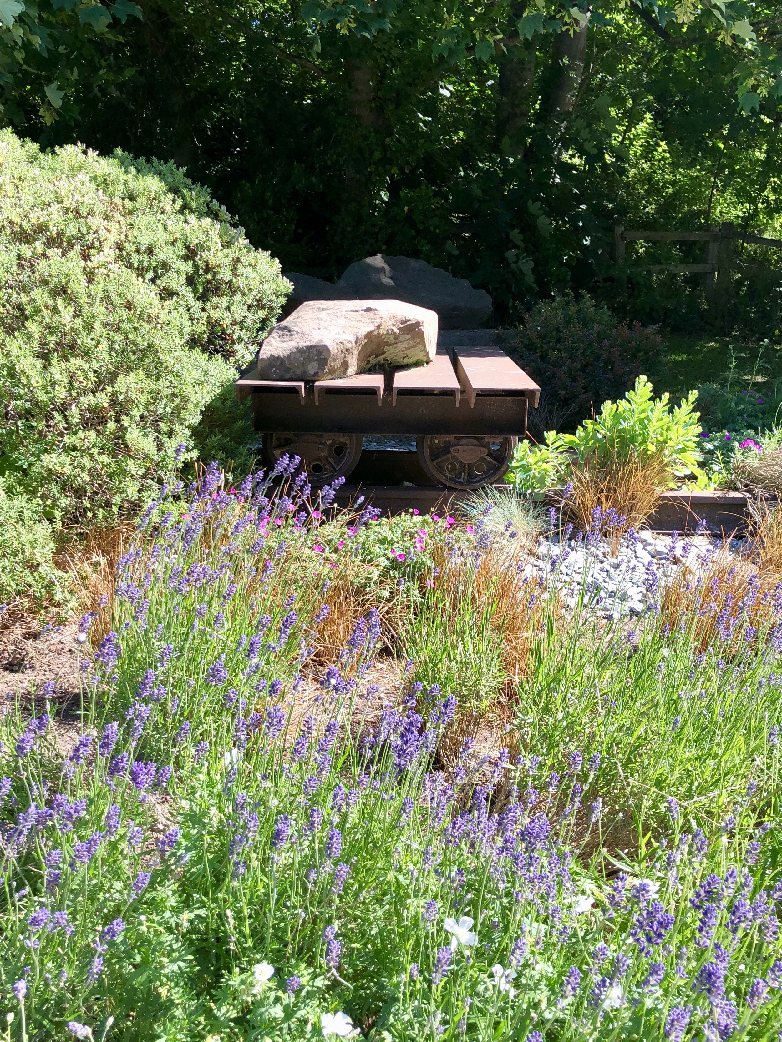
The Ropewalk Garden
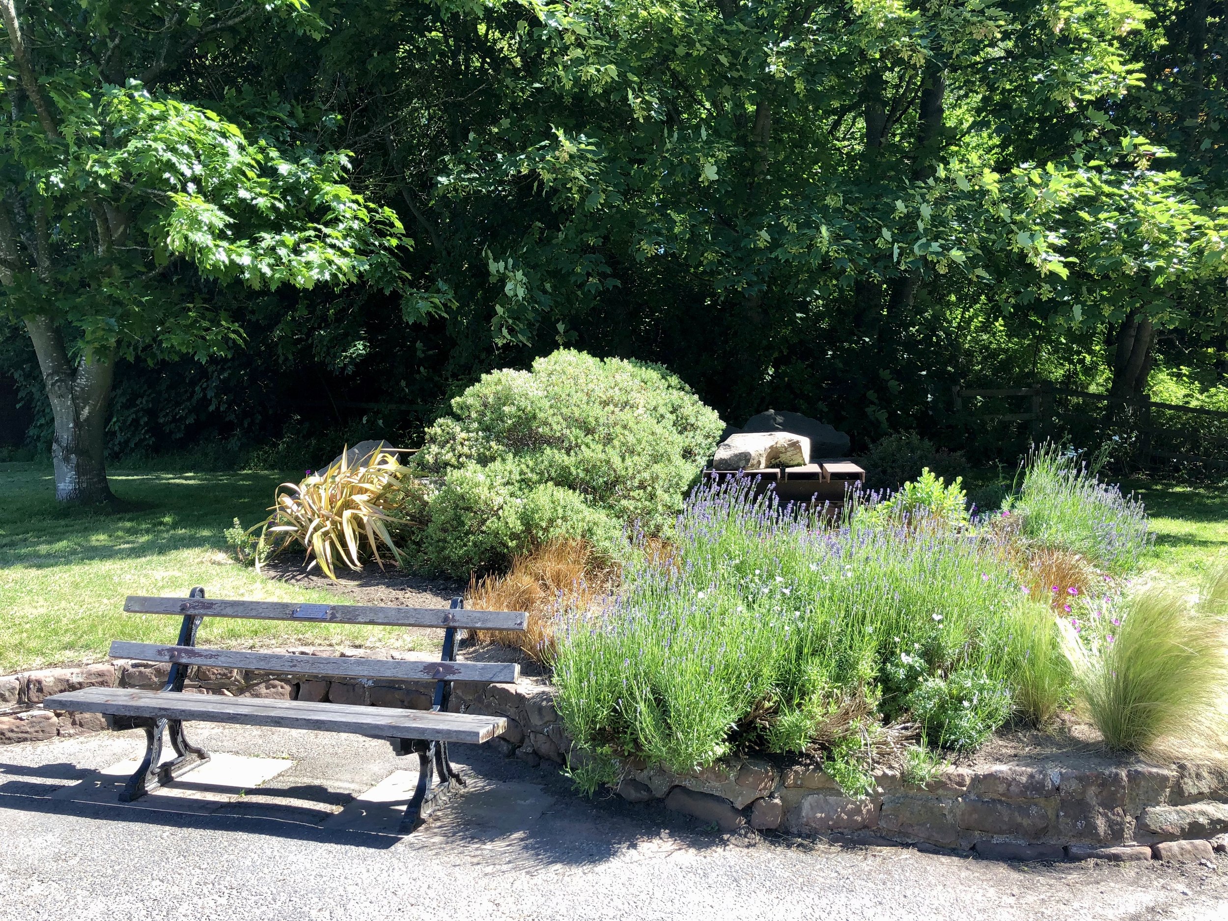
The little garden on the corner with Station Road was established some years ago by a joint effort involving the Society, the local council and other groups, when a well-wisher donated a small railway trolley to remind passers- by that there was once a railway here conveying traffic from the local coal mine at Little Neston. The Society has been involved in the maintenance of the area, with the planting of flowers, pruning of growth and weeding. We have also donated a bench in memory of our past Chairman Dr Geoffrey Place, and have recently replaced the small plaque which commemorates the original scheme. The Society would like to install an interpretation board at this location describing the impact of the railway on the subsequent development of Parkgate.
Actions: the Society maintains this recreational area and is working with Cheshire West and Chester Council on the design and funding of a new historical interpretation board at this location.


Ropewalk Park and Children’s Play Area

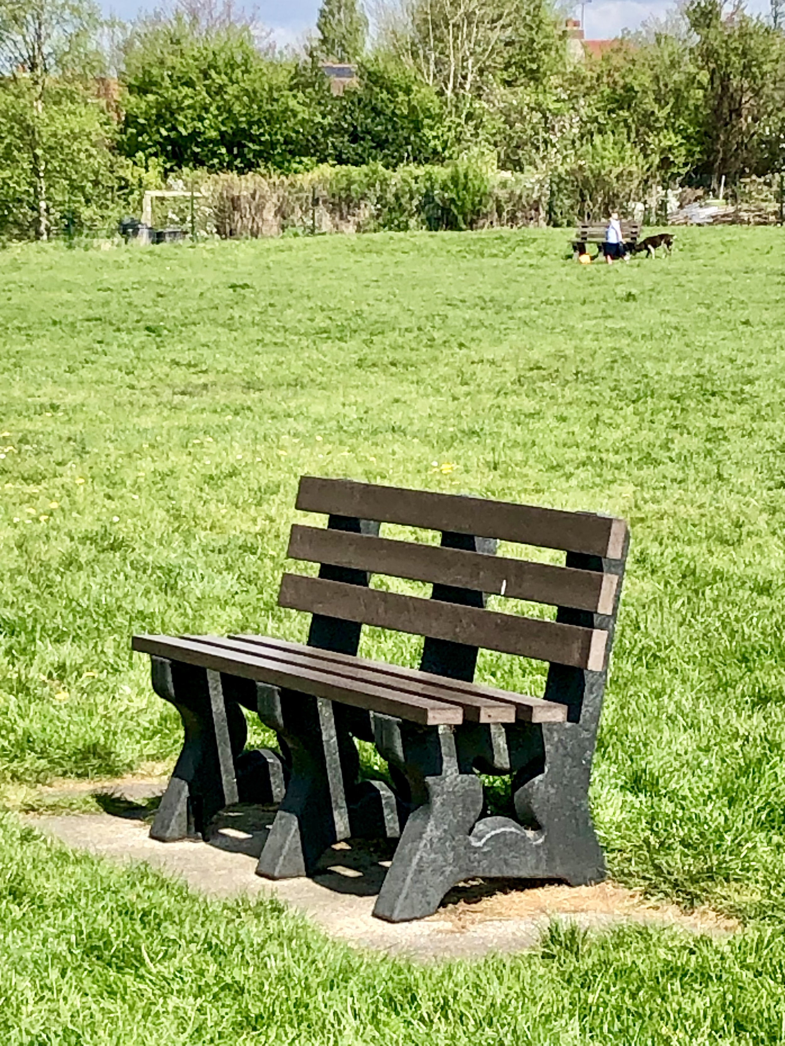


This is an attractive and generally quiet open green space surrounded by different types of housing and also backing onto the Parkgate School playing field. It is accessed from different areas via the Ropewalk and is maintained by Neston Town Council. Adjacent to the northern boundary is a small area of allotments. The children’s playground is well furnished with equipment and generally well used. A couple of benches have been installed in the main area, but it is not clear how much use they get.
Actions: the Society’s Community Spirit team continues to monitor the litter situation.
Park Fields and Wood Lane
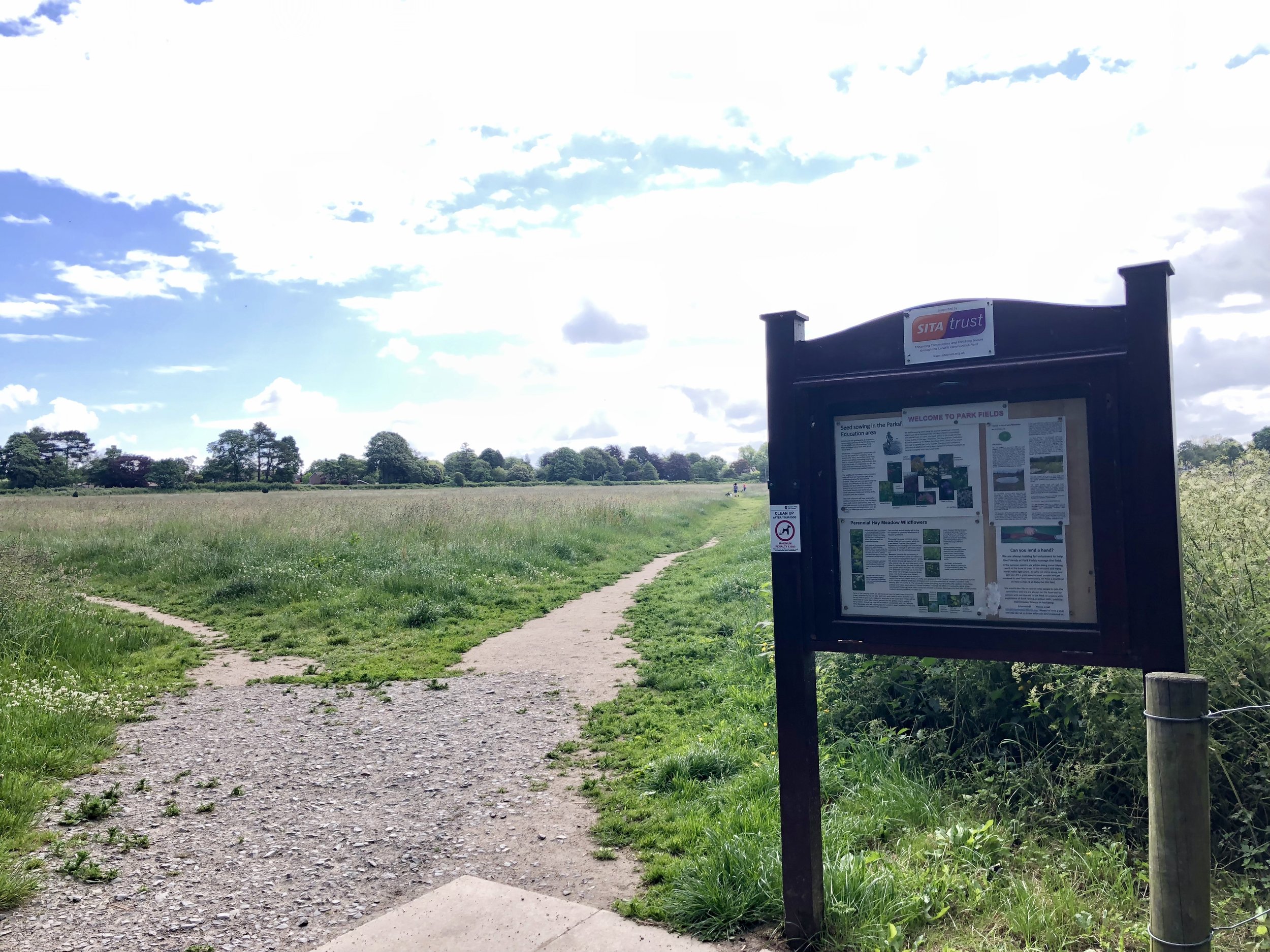
Park Fields
The line of this ancient right of way identifies the eastern boundary of the former Neston hunting park; now an unadopted road, it appears to have once served as part of a direct route between Neston and Gayton. At the turn of the 20th century it extended from Neston only as far as the 'cow path', which is the extension of Brooklands Road and the northern boundary of the former park; it then provided access to just one house 'Belcarrig', later demolished to provide the site for the Paddock Drive development. It continued as a footpath only via Backwood Hall to Gayton village. The present lane is much used by walkers and cyclists, being part of cycle route 56. Adjacent to the west is a playing field and a former cow field, this now maintained as a public open space by the Friends of Park Fields, awarded Green Flag status and also recognised with an award by the QE II Jubilee Trust.
In Spring 2022 and 2023 the Friends of Park Fields planted a new wild flower meadow in the old cow field, creating a glorious splash of colour to the fields through spring and summer.
Lack of maintenance of the lane has created a hazardous surface for cyclists and other users, and a short section has also become subject to serious flooding from an underground culvert in Brook Lane, effectively making the route impassable for walkers at times. Car parking in Wood Lane adjacent to the playing field has become a problem at certain times. This could be alleviated by the creation of additional off-road spaces at the Parkgate Road entrance to the field. Consideration is currently being given to upgrading the section between Earle Drive and Paddock Drive.
Actions: the Society continues to monitor the situation and support schemes to address the problems identified.


The Green Belt

The Cheshire Green Belt began to be developed during the 1960s and was formalised in Councils' local plans in the 1980s, the aim being to halt the encroachment into the Cheshire countryside of development arising from pressures in the neighbouring conurbations. Over 40% of Cheshire West falls within the green belt, and Neston is ringed by green belt land. The purpose in this locality is to maintain the open space between Neston and Heswall, and the presumption is that further housing and other development will not be permitted in the countryside. The Society is affiliated to Cheshire CPRE through its membership of the Wirral Society, and endorses this policy, which is an integral feature of both the Neston Neighbourhood Plan and the Cheshire West and Chester Local Plan. In the past we have objected to any development proposals which appear to be contrary to these policies, and we will continue to do so.
Actions: the Society will continue to encourage Cheshire West and Chester to uphold its policy with regard to the maintenance of the integrity of the Cheshire Green Belt, when taking decisions on development proposals, particularly affecting this locality.
The KING CHARLES III English Coast Path
The King Charles III England Coast Path is the the longest managed coastal path in the world. When completed it will go all the way around the coast of England and will be around 2,700 miles long when it is complete.

Birkenhead to North Wales coastal path
This long-distance path, connecting with the Welsh Coastal Path at the national boundary near Burton, is planned to run as close as possible to the coast of the Wirral.
Work was done In 2012 to open up the section between the Flintshire border and Neston.
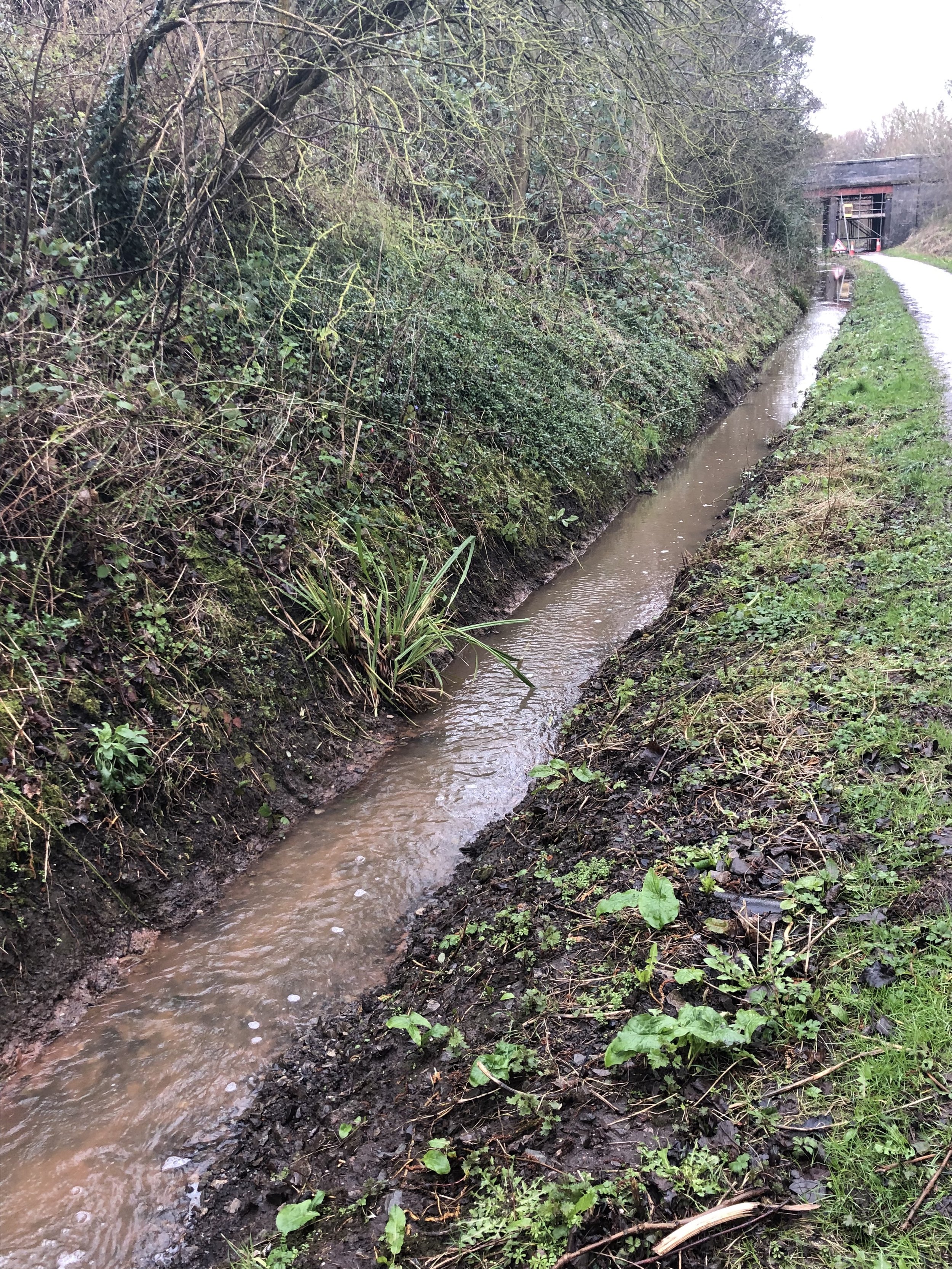
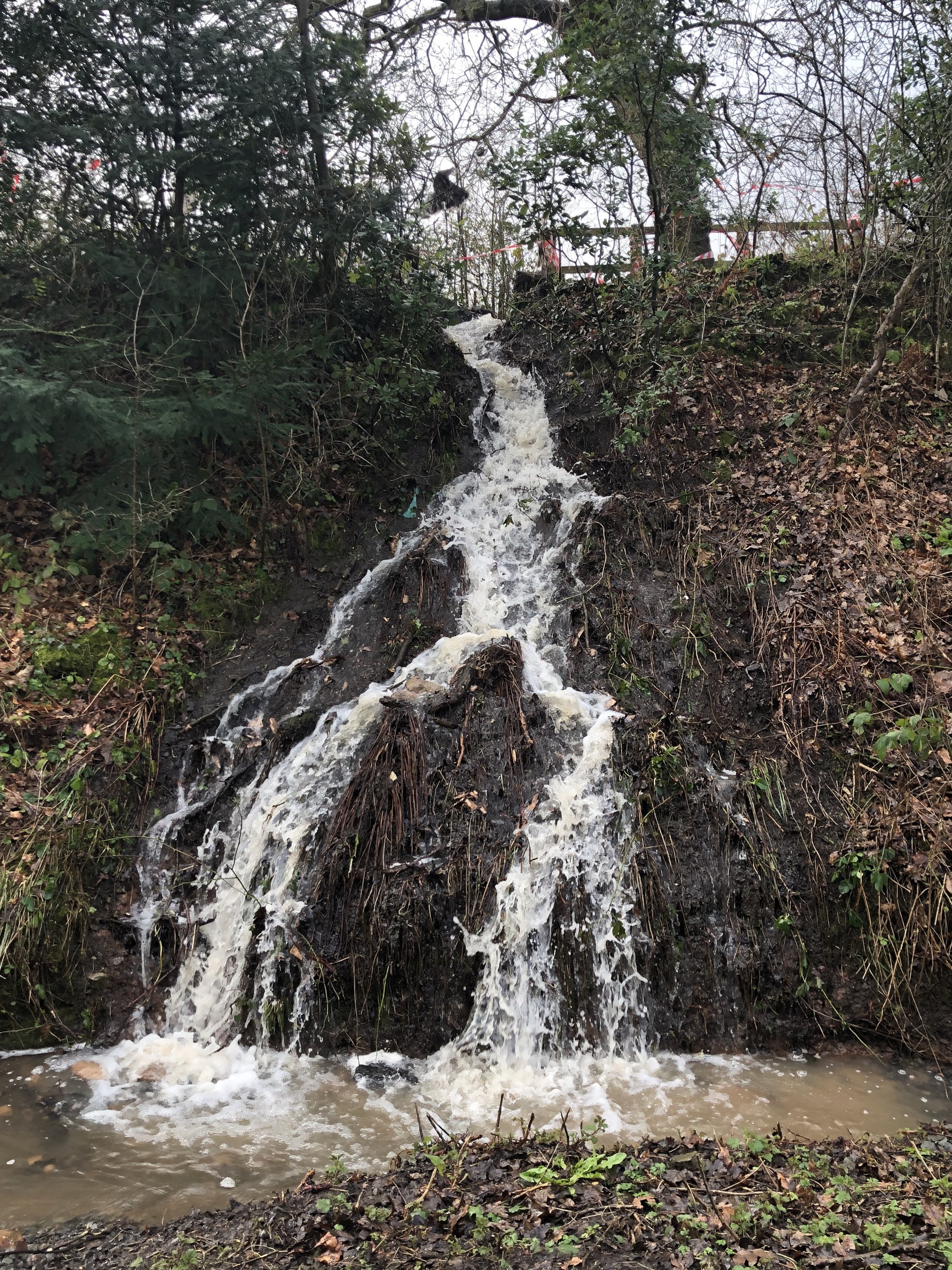
The missing Parkgate section will be completed in 2024: running from The Boathouse to Marshlands Road in Little Neston (Section BHW3), The work is due to start in January 2024 and will be completed by March 2024.

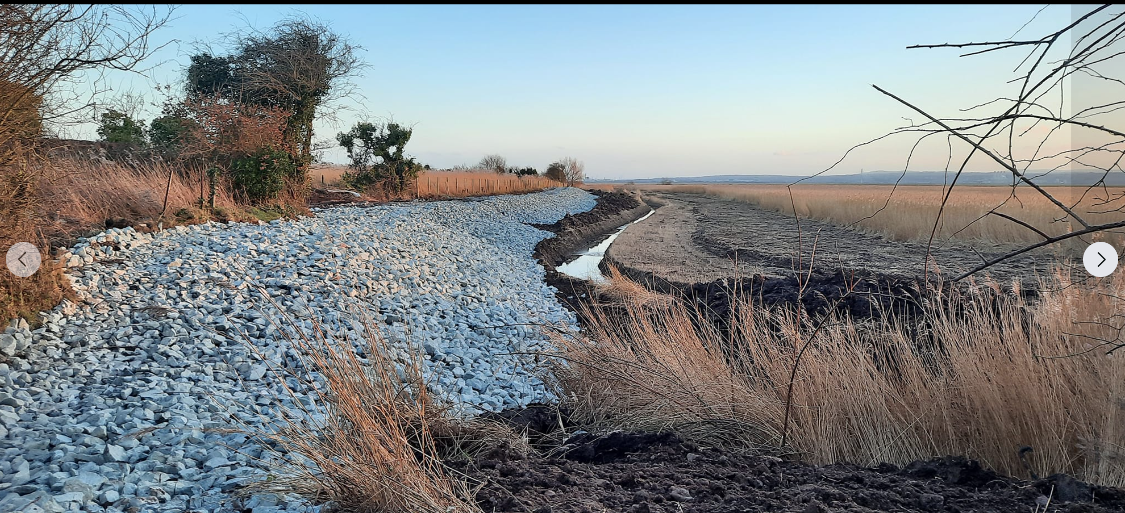
January 2024: Parkgate Spring with construction in progress.
Last Updated February 2024