
Parkgate Heritage Trail
The Heritage Trail is a walk introducing Parkgate’s history, taking in a number of places of interest along Station Road and The Parade. There are a couple of information booklets about the history of Parkgate:
“Parkgate Heritage Trail” (£2.00)
“This is Parkgate” (£2.00)
These can be purchased from Nicholls Ice Cream Parlour in Parkgate, or you can purchase them online below.

The Walk
Distance: 1 mile
Start Point:
The Ropewalk Car Park, Station Road.
This is a free public car park.

1) The Station & Pill Box
This building is a World War 2 ‘pill box’, built in 1940 to defend the former railway bridge that crossed the road near here, when the line was extended to West Kirby.
It has now been re-purposed as a home for bats.

Ropewalk Car Park
This car park is the site of the original Parkgate railway station; built in 1866, it was a terminus, the end of the line from Hooton.

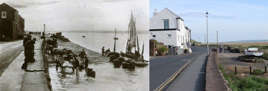
2) Old Quay Corner
This is the point where Station Road meets The Parade and the sea wall. Some of the houses here date from the early Georgian period, when Parkgate was an active port.
Roughly where the lamppost is now there once stood the old customs house, one of a group of buildings that were demolished to create the site for the Old Quay public house, which opened in 1963.

3) South Parade
The South Parade is now dominated by the Old Quay public house.
Looking in a northerly direction the tall outline of the former Mostyn House School can be made out.

4) Mostyn House
The black and white feature of many of the buildings in Parkgate owe their origin to Rev. AG Grenfell, the headmaster of Mostyn House School from 1893 to 1933; at the heart of this building was the former Mostyn Arms Hotel, which became a school in 1855. The four-storey block was added in 1897, while the current façade dates from 1932, when the building was found to need strengthening.

5) Balcony House
This pair of houses date from about 1750 and were much associated with the then popular practice of sea-bathing. To the rear an assembly room was added in about 1780. The balcony, which gives the building its name, was added in 1868.
The adjoining South Cottage, now the Little Teahouse, is older and is believed to date back to 1708; it is the remaining part of the former White Lion Inn which before 1851 extended forward into what is now the roadway.

6) The Donkey Stand
The Donkey Stand is a projection of the sea wall. This was necessary because, when the wall was built c1800, a building stood here on the seaward side of the roadway.
It was the village’s first assembly room, later hot & cold baths and, when demolished in 1840, left this useful communal space.

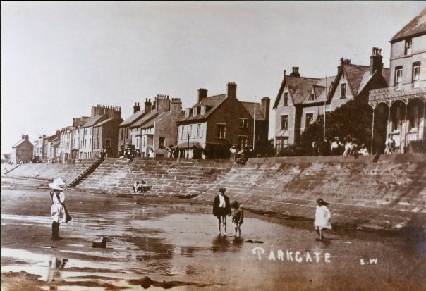
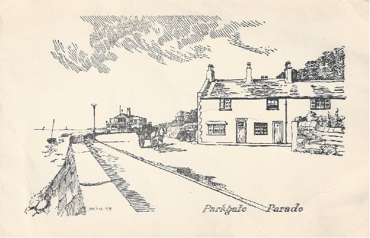
7) The Parade
In this view can be seen (from left to right): Parade House (early 18th C and originally separate houses) now containing Britannia Spice and Parkgate Ice Cream shop, Nicholls Ice Cream (1935) and the Ship Hotel (18th C and recently renovated).
8) THE SHORE AND WATER
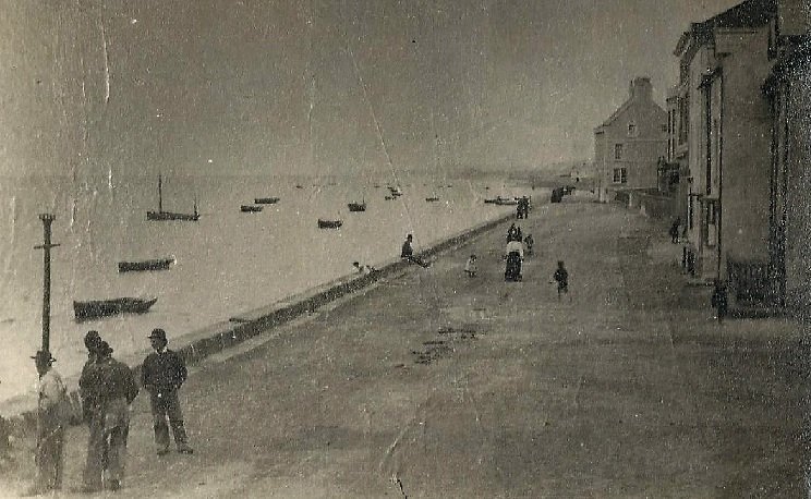
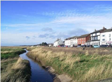
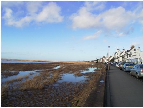
Over the years a huge quantity of silt has been deposited on the Cheshire side of the Dee estuary; this is a result of the diversion of the main stream of the river in the early part of the 18th century in order to enable shipping to regain access to Chester. The ground level here has been raised by many feet to the point where it is now no longer covered by ordinary tides. The resulting marsh is intersected by numerous dangerous channels. At spring tides, however, the tides continue to reach the sea wall and to deposit further quantities of silt. These occasions offer a good opportunity to watch the local wildlife, as birds and mammals are displaced by the rising waters.

9) Central Parade
Most of the properties on this part of The Parade date back to the 18th century, as does the Red Lion pub, shown here. In places the roadway is very narrow and congested. A number of narrow weints (alleys) lead from the Parade, providing access to properties in the rear.

10) St ThomaS’ Church & Mostyn Square
Long known as ‘The Fishermen’s Church’ this building was constructed as a Congregational chapel in 1843; it became a Presbyterian chapel in 1858, before being superseded by a new church in Parkgate Road in 1884; it was then leased by the Church of England from 1910 and bought by them seven years later. After about 16 years out of use, it was renovated and re-opened for worship and community use in 2010. To the right, set further back, can be seen the Coastguard Cottages of 1860.
11) THE MIDDLE SLIPWAY AND THE OLD WATCH HOUSE
This slipway on which the boat stands was the northern extremity of the original section of the sea wall, when completed about 1810 or, perhaps, a little earlier. It was a great centre of activity when used by local fishermen to land their catches at high tide.
It is overlooked by the Old Watch House, which precedes it by almost a century; from 1799 to 1828 this small cottage was leased by the Customs service, who used it to keep an eye on local shipping at a time when smuggling was prevalent in the area. The loss of this trade made the building redundant, and since then it has been a private house, considerably extended since the last war.
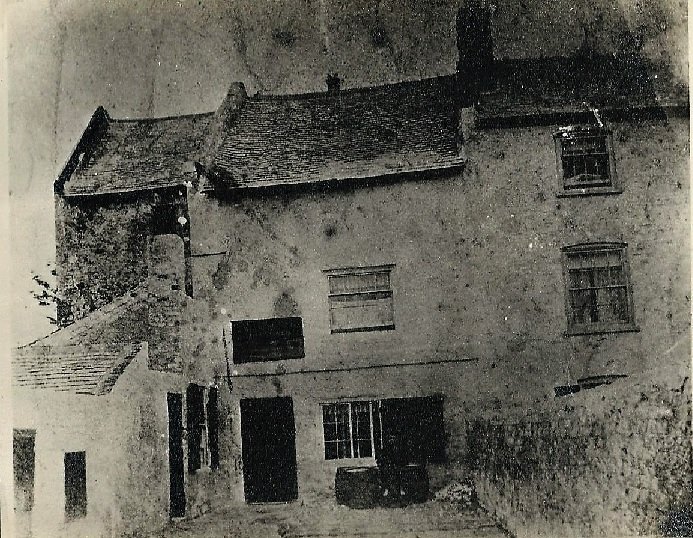
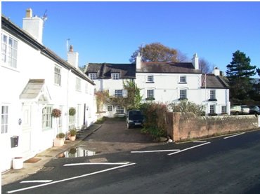
12) PENGWERN PLACE
This grouping of houses is collectively known as Pengwern Place. Pengwern itself (on the right) and the neighbouring Sawyers Cottage are amongst the earliest surviving buildings in Parkgate, dating from about 1700 or a little earlier: Dee Cottages (on the left) are somewhat later. Pengwern is believed to have been the home of one of Parkgate’s sea captains and ship owners, while the cottage was the Sawyers Arms public house between 1793 and 1905,

13) The Boat House
This pub and restaurant The Boathouse was opened as The Boathouse Café in 1926 and extended in 1977.
It is built on the site of the former Pengwern Arms, an old coaching inn, which was demolished in 1885 following storm damage a little earlier.
It was from here that until 1863 a ferry service operated to Bagillt and Flint, forming one stage of an important transport route between north Wales and Liverpool.
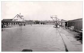
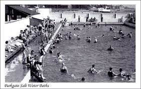
14) THE OLD BATHS
In 1923 a substantial swimming pool was built here by Mostyn House School – the boys were involved in its construction – and a second, smaller bath was added on the seaward side in 1930. Water was extracted from the Dee estuary at high tide and filtered. There was accommodation on site at the Bath House for the baths manager and his family, whose wife was manager of the café there. These baths were extremely popular with the public during the inter-war period, but they were sold off in early 1939 to provide capital for construction of the School’s air-raid shelter.
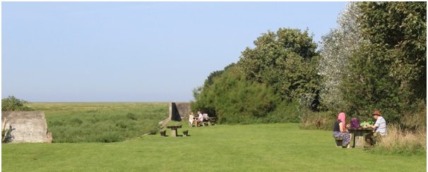
During the war years the encroachment of the marsh made it increasingly difficult to maintain the water supply, and the baths finally closed in 1950. The site was subsequently filled and later incorporated into the Wirral Country Park. Only a few lengths of the external walls still remain.
End Point: Old Baths Car Park. This is a free public car park.
Last Updated July 2023