
Parkgate Marshes and High Tides
Parkgate Tide Timetable
The tide times at Parkgate occur about 30 - 40 minutes after those at the Gladstone Dock in Liverpool, and a further 15 minutes can elapse as the water seeps across the marsh to reach the sea wall.
You can get high tide information from the Tideschart website, as well as weather and fishing information for Parkgate and Neston.
The National Oceanography Centre, Liverpool also gives high tide information.

Parkgate Marshes
The marshes have accumulated at Parkgate over the last century or so, and like the rest of the Dee estuary are thought to increase in height by a few centimetres each decade. The main channel of the Dee estuary switched to the Welsh side following the building of the New Cut in 1732 to improve navigation to Chester, and there was also considerable land reclamation (evidently 25% of the original Dee estuary). The silting up of the Dee was exacerbated by the introduction of Spartina grass to the estuary in 1928 and has arisen mainly from net import of sediment from the Irish Sea as explained in various reports and scientific articles:
The Dee Estuary Report, part of the North West Estuaries Processes Reports (2013). The Executive Summary of this report is particularly useful.
The Spatial and temporal changes in salt marsh distribution in the Dee estuary, NW England, determined from aerial photographs published by the Springer.com website (2004)
Morphological evolution of the Dee Estuary, Eastern Irish Sea, UK: A tidal asymmetry approach, Science Direct (2009)
When the tide rises, the marshes are not flooded in the way a sandy beach is. Rather, the water rises through numerous channels and gullies which may overspill in very high tides to inundate the intervening ground. The image below shows how this happens.

It is notable at Parkgate that there is a ridge running north-south a couple of hundred yards “offshore” from the Parade (see line of blue stars), creating two “watersheds”. One fills through gullies from the main estuary channel (yellow centre); the other, nearer one, fills from the gulley which runs parallel to Parkgate Parade (red arrow). This gully is called Gayton Hole, though nowadays this begins in the estuary at the northern end of Heswall.
This ridge of higher marsh is the location of a series of small pools which fill only intermittently from the tide, optimal conditions for saltwater mosquitoes to breed.
The tidal range of the Dee estuary is quite large, similar to that seen at the nearby reference point at the Gladstone Dock in Liverpool. Spring tides occur when the moon is either new or full, and the Sun, Earth and Moon are aligned. When this is the case their collective gravitational pull on the Earth's water is strengthened and the tidal range is at its greatest. At Parkgate these spring tides, typically occurring February - April and September - November, may be associated with a high tide far exceeding 10m and reaching the sea wall on Parkgate Parade.
On such occasions the spring high tide overwhelms the ridge and reaches the sea wall by the direct route. When such high spring tides coincide with strong westerly winds and a barometric depression, the water levels may be sufficient to cause flooding on the Parade.
You can read about the tides and sea levels at the National Tidal and Sea Level Facility (NTSLF).
Impact on wildlife
These high tides cause lots of the wildlife on the marsh to run ashore, bringing in birds of prey and this draws many hundreds of bird enthusiasts to Parkgate to view and photograph these sights.
On these occasions, the RSPB sets up information points on the Donkey Stand and at The Old Baths car park.

High Tide at the Old Baths Car Park, February 2024 © Robert Clive
Parkgate high tides over the years
There are many old photographs which show the high tides at Parkgate, some of them breaching the sea wall.
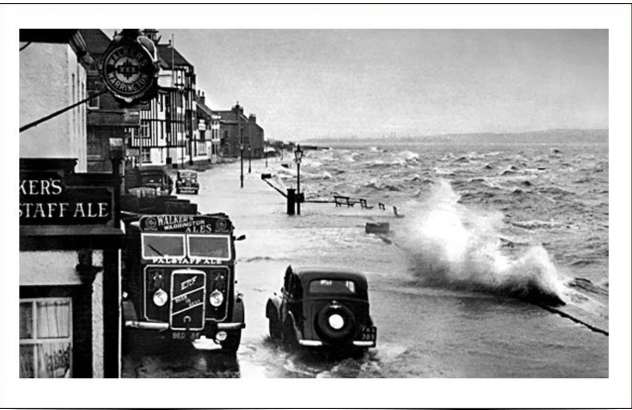


The most recent breach of the sea wall happened on Friday 6th December 2013. On that day there was a spring tide, low atmospheric pressure across the country which increased the height of the predicted tide, and a strong wind coming in from the Irish Sea driving the tide into the estuary. The result was an abnormally high level of seawater coming up over the sea wall. There was a report in "About My Area" on the event.
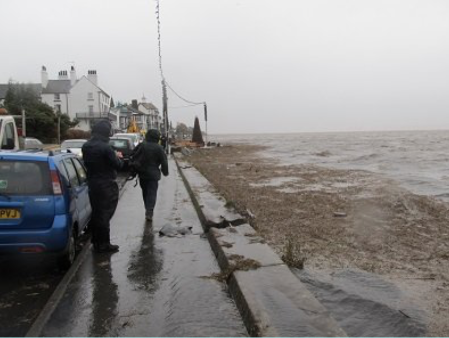


Spring Tide March 2023 © Dave Mort

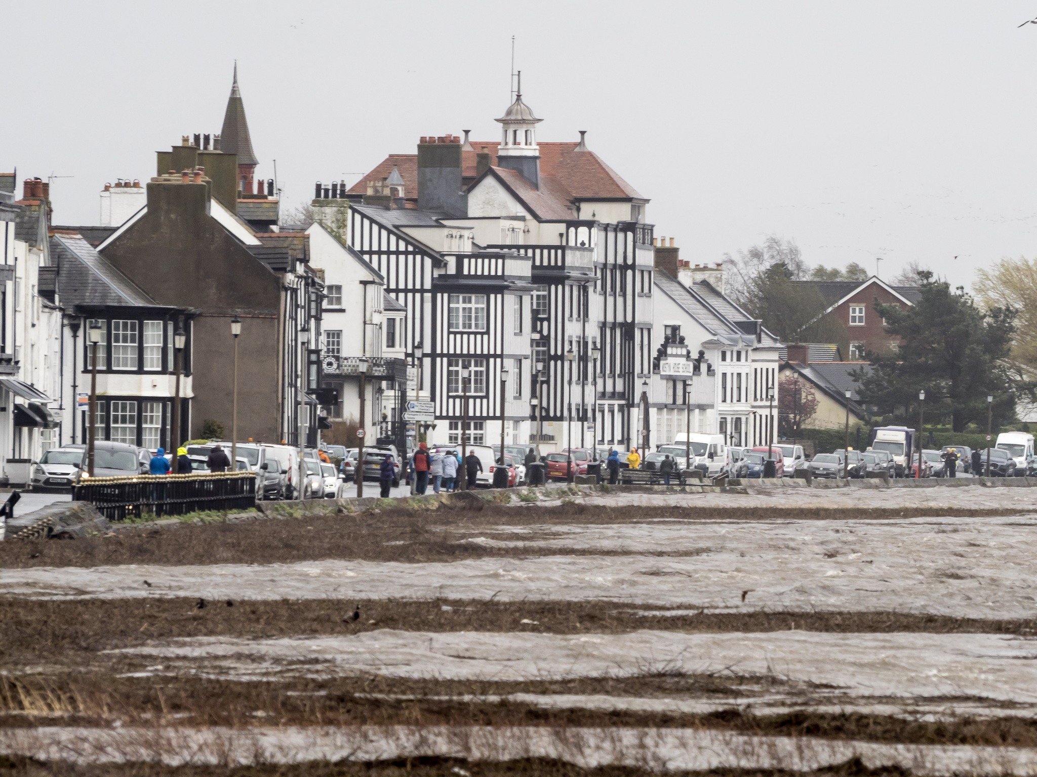
Spring Tide February 2024
The very high tide April 2024
Last Updated February 2024